You are here
Diplomacy & Defense Think Tank News
Royaume-Uni, Brexit : Theresa May dévoile les objectifs du Royaume-Uni
Le 17 janvier, Theresa May, Première ministre britannique, a dévoilé ses objectifs après la sortie de son pays de 'l'Union européenne. Elle a déclaré que l'accord final sera soumis aux deux chambres du Parlement.
Categories: Diplomacy & Defense Think Tank News
Royaume-Uni, Elections en Irlande du Nord le 2 mars
Le 16 janvier, James Brokenshire, ministre britannique en charge de l'Irlande du Nord, a annoncé que les prochaines élections au parlement nord-irlandais se tiendraient le 2 mars, après la crise politique qu'a provoqué la démission du vice-Premier ministre et figure du Sinn Fein Martin McGuinness le 9 janvier.
Categories: Diplomacy & Defense Think Tank News
Royaume-Uni, Délocalisations bancaires post-Brexit
Le 18 janvier, HSBC a déclaré qu'un millier d'emplois devraient être déplacés à Paris lorsque le Royaume-Uni aura quitté l'Union européenne. Goldman Sachs envisagerait de délocaliser 1 000 de ses salariés à Francfort et JP Morgan 4000. Lloyds souhaite ouvrir une filiale en Allemagne.
Categories: Diplomacy & Defense Think Tank News
Ukraine, Le Royaume-Uni continuera de soutenir l'Ukraine
Le 20 janvier, Michael Fallon, ministre britannique de la Défense, a annoncé que le Royaume-Uni continuera à soutenir les forces ukrainiennes face à la Russie.
Categories: Diplomacy & Defense Think Tank News
Ukraine, L'Ukraine attaque la Russie devant la Cour internationale de justice
Le 17 janvier, l'Ukraine a intenté une action contre la Russie devant la Cour internationale de justice pour des violations de la convention internationale pour la répression du financement du terrorisme du 9 décembre 1999 et de la convention internationale pour l'élimination de toutes les formes de discrimination raciale du 21 décembre 1965.
Categories: Diplomacy & Defense Think Tank News
Conseil de l'Europe, Lettre du secrétaire général à la Douma et au Conseil de la Fédération de Russie
Le secrétaire général du Conseil de l'Europe Thorbjørn Jagland a envoyé une lettre aux présidents des deux chambres du Parlement russe sur ses inquiétudes concernant le projet de loi qui vise à dépénaliser la violence domestique en Russie.
Categories: Diplomacy & Defense Think Tank News
Eurostat, Hausse du taux d'inflation en Europe
Selon les chiffres publiés par Eurostat le 18 janvier, le taux d'inflation annuel de l'Union européenne s'est établi à 1,2% en décembre 2016, contre 0,6% en novembre et celui de la zone euro s'est établi à 1,1% en décembre 2016, contre 0,6% en novembre.
Categories: Diplomacy & Defense Think Tank News
Eurostat, Excédent de 15,8 milliards € des échanges courants de l'Union européenne
Selon les estimations d'Eurostat datées du 19 janvier, le compte des opérations courantes de la balance des paiements de l'Union européenne a enregistré un excédent de 15,8 milliards € en novembre 2016, et de 11,8 milliards pour la balance des services.
Categories: Diplomacy & Defense Think Tank News
Etudes/Rapports, Rapport de l'OCDE sur la gestion des nouvelles technologies de santé
Le 16 janvier, l'OCDE a publié un rapport sur la gestion des nouvelles technologies de santé.
Categories: Diplomacy & Defense Think Tank News
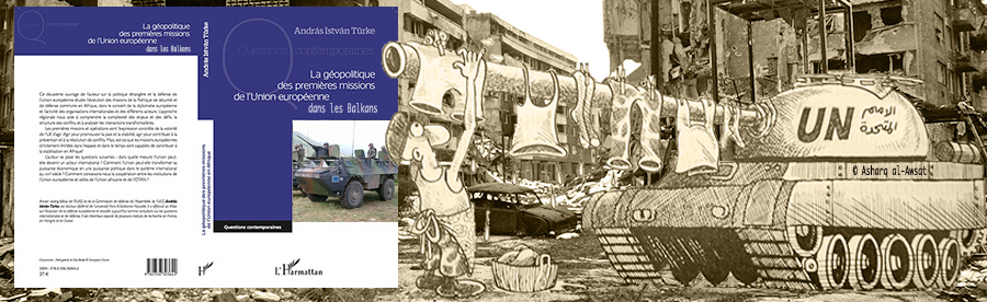
Etudes/Rapports, Banque mondiale : rapport sur le secteur financier des Balkans
Le 16 janvier, la banque mondiale a publié un rapport sur le secteur financier des pays des Balkans dans lequel elle appelle les responsables politiques à rééquilibrer leurs secteurs financiers pour encourager la croissance à long terme dans la région.
Categories: Diplomacy & Defense Think Tank News
Culture, Exposition consacrée à Michael Andrews
Du 20 janvier au 25 mars, la Gagosian Gallery à Londres organise une exposition sur le peintre britannique Michael Andrews et ses peintures de paysages écossais et australiens.
Categories: Diplomacy & Defense Think Tank News
Culture, Exposition consacrée à Willy Fleckhaus
Du 20 janvier au 7 mai se tiendra au Musée des Arts et Métiers (MKG) de Hambourg une exposition consacrée au designer allemand Willy Fleckhaus. Plus de 350 oeuvres de l'artiste seront présentées à cette occasion.
Categories: Diplomacy & Defense Think Tank News
Culture, Festival du film français à Vilnius
Du 26 janvier au 10 février se tient à Vilnius, en Lituanie, le festival du film français intitulé "Ecrans d'hiver".
Categories: Diplomacy & Defense Think Tank News
Culture, 41ème édition de l'Arte Fiera à Bologne
Du 27 au 30 janvier, se tient à Bologne, en Italie, la 41ème édition de l'Arte Fiera, une foire internationale d'art moderne et contemporain.
Categories: Diplomacy & Defense Think Tank News
Culture, Essen devient la Capitale verte de l'Europe pour 2017
Le 21 janvier, la ville d'Essen en Allemagne est officiellement devenue la Capitale verte de l'Europe pour 2017.
Categories: Diplomacy & Defense Think Tank News
Culture, Le salon international d'art contemporain à Paris
Le salon international d'art contemporain revient à Paris pour la 3ème année consécutive du 27 au 29 janvier avec plus de 200 exposants internationaux.
Categories: Diplomacy & Defense Think Tank News
Der Regeni-Mord und seine Folgen für die westliche Ägyptenpolitik
Categories: Diplomacy & Defense Think Tank News
Fillon zu Gast in Berlin: „Unseren Platz in der Welt verteidigen oder verschwinden“
Frankreichs möglicher neuer Präsident Francois Fillon sieht Europa vor einer historischen Entscheidung. Er warb für mehr Selbstbewusstsein Europas.
Categories: Diplomacy & Defense Think Tank News
Professor Theodore Couloumbis writes on the Cyprus Question in the Sunday edition of Kathimerini, 22/01/2017
You can read here the article on the Cyprus Question, which was written by Professor Emeritus and Member of the Board of Trustees of ELIAMEP Theodore Couloumbis. This commentary was published on 22 January 2017 in the Sunday edition of Kathimerini. It is available in Greek.
Categories: Diplomacy & Defense Think Tank News
10 Fragen - 10 Antworten: Donald Trump als Präsident der USA
Ruhe vor dem Sturm? Heute wird Donald Trump als 45. Präsident der USA in Washington, D.C. vereidigt.
Categories: Diplomacy & Defense Think Tank News
Pages


© 2012-2018 Europa Varietas Foundation © 2015-2018 Europa Varietas Association
www.europavarietas.org | info(@)europavarietas(dot)org | Switzerland
We are looking for sponsors for the English translation of these books, please contact turkeandras(at)gmail(dot)com